|
BTOPO |
|
|
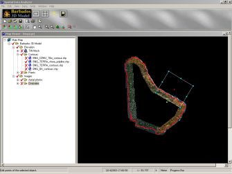
Barbados Topography BTOPO is a comprehensive database of topographic and bathymetric elevations for the entire island of Barbados. Sources included LIDAR, soundings, cross-sections, and digitized contours from a variety of surveys. The Barbados 3D Model system is accessed through our software product SDA, which presents the data within a 2D GIS framework. Aerial photography is also accessible for the entire coastal zone. From within SDA, users are able to easily create grids for any portion of the island in order to run numerical modeling simulations. For any generated grid, raw data and aerial photos may also be exported.
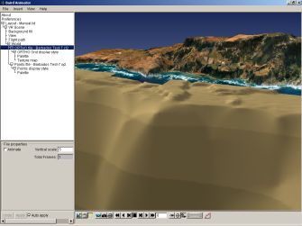
The system also includes Baird's 3D visualization application, Baird Animator, for viewing exported data and producing 3D output such as images and movies. Aerial photos can be draped over topography, and flight-paths through the dataspace can be generated to produce impressive animations for presentation.
|
|