|
MapAnimator 3D Animations |
|
|
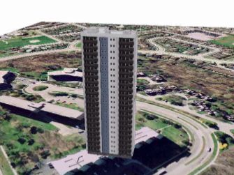
Highrise Residential Preview.mpg (~8.8Mb) This animation shows a fly-around of an apartment building to highlight the more complex objects that can be symbolized in ArcScene version 9. The flightpath for this animation was created in a matter of seconds with just 3 camera control points. |
|
|
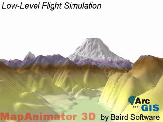
Mt St Helens Low-level.mpg (~14.0Mb) This animation provides a 3D fly-through up and over a river valley south of Mt. St. Helens in Washington State. The elevation model is a standard USGS 30m DEM. This animation highlights the text and graphic overlays that can be created by MapAnimator. All system fonts can be used, and each text element can be adjusted with colour, placement, transparency, bold/italic, etc. Also, graphic bitmaps from many formats can be inserted as overlays, and their placement, scale and transparency are flexible. |
|
|
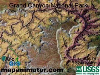
Grand Canyon Landsat5.mpg (~21.1Mb) This animation provides a 3D fly-through of a portion of the Grand Canyon near Powell Plateau and Havasu Falls. The elevation model is a standard USGS 30m DEM. This animation highlights MapAnimator's ability to create complex yet smooth camera movement through a scene, allowing discrete control over camera directional aiming, independent of the camera's movement. |
|