|
MapAnimator 3D |
|
|
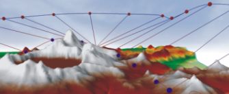
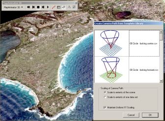
* This product has been discontinued. MapAnimator 3D is an extension for ESRI's ArcGIS ArcScene application that allows you to instantly create a smooth camera path through your complex 3D data. Choose from a variety of pre-defined paths that can be automatically scaled to one or more data sets in your scene. Instantly apply a complete flight path to your own datasets. A virtual windshield keeps your cartographic surround elements visually available as you fly through your 3D Scene. Legends, titles, and logos can all be included here. This overlay layer remains fixed in front of the 3D animation. MapAnimator 3D provides all of the functionality you need to transform your data into animated movies using industry standard formats MPEG and AVI. |
|