|
Spatial Data Analyzer |
|
|
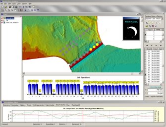
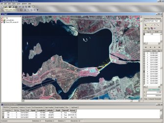
In addition to standard GIS functionality (editing, querying, registering, analyzing and presenting spatial data), SDA facilitates the seamless integration of 4D data generated by numerical models such as hydrodynamic models, temporal data from field observations, and time-series images acquired from remote sensing platforms such as satellites. SDA easily manages and displays multiple dynamic data sets, providing tools to navigate and edit temporal and spatial data. The ability of SDA to view dynamic data sets together with conventional static data layers expands the analysis potential of GIS. Attribute and display tools allow the user to specify graphic symbology, including dynamic vectors and barbs, colors, transparencies and hierarchies. Referencing tools such as dynamic time scales, legends and north arrows ensure easy interpretation. Complex data sets can be transformed and visualized as maps or animations with dynamic data draped over static GIS layers. SDA's wide range of export options guarantee that data, maps and animations can be shared and distributed among clients and work groups. |
|